Available OnDemand
From zero to hero!
The learning curve for new technology and software can be steep and challenging, but Concexpla's survey team managed to do it in no time with Bentley's reality modeling software, ContextCapture.
Discover how Surveyor, Paulo Berão and his team mastered drone and ground photogrammetry to produce 3D models for heritage studies and topographical projects. Using ContextCapture, the team was able to quickly get up to speed to implement a geospatial workflow to save time and money on their projects.
In this interview, Paulo will share his experience and reality modeling best practices for topographic work and studies using drone and imagery techniques.
What you will learn from the interview:
- Introduction to Reality Modeling solutions for small companies.
- Explore how to switch from the conventional topography to a hybrid approach combining photogrammetry, laser scanning, and land surveying support.
- Learn about the use case: Concexpla Masters ContextCapture for Heritage and Topographical Projects in Zero Time
- Discover how to save time and money using Reality Modeling workflows in your projects.
- Understand the learning pathway for ContextCapture and how Virtuosity Keys can help.
- And learn how to use drone photogrammetry and ContextCapture, and increase productivity with our tailored training and support package.


Watch Now
Presenters

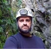
Paulo Beirão
Surveyor
Concexpla
Surveyor for more than 15 years, Paulo is graduated in Cultural Heritage, with a master's degree in Archaeology.
Working for Concexpla since 2016, Paulo is responsible for surveying and topography projects using conventional methods together with Reality Modeling based on UAVs and TLS systems, relying on Bentley’s software.
Nowadays, he’s working on several fronts such as Topography, Cartography, Geographic Information Systems, Cultural Heritage, and Archeology.

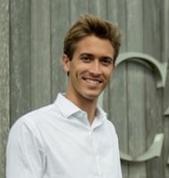
Ruben Minjauw
Sales Engineer for Reality Modeling
Virtuosity, a Bentley Company
Coming from Aerospace Industry, he developed his interest and expertise in Drone and their applications such as Photogrammetry Industry. After some years of experience in most well-known aerospace companies around Europe (Safran, Rolls-Royce, Iberia), he progressed into Engineering Software Development, working at Dassault Systems as a solution consultant for 3D product design, simulation, and manufacturing software.
He works at Virtuosity, a Bentley Systems company, as a Product Sales Engineer in Madrid, promoting the benefits of integrating Reality Modeling into engineering workflow. He is absorbed in digitalization and its progress transforming our lives as individuals and as a society.

Filipe Pinto
Sales Engineer for Reality Modeling
Virtuosity, a Bentley Company
Graduated as a Surveyor Engineer, with a Master's Degree in Science and Geographic Information Systems, Filipe has been working for 13 years in Surveying, 3D Mapping & GIS widely with public organizations and AEC companies. He's been involved in the development of a wide range of projects, across Europe and Latin America. For the most diverse purposes involving the reality capture and modeling, analysis, management, and sharing of geospatial information.
Now, as a Sales Engineer at Virtuosity, a Bentley Company, he is responsible for promoting Reality Modeling solutions (Orbit 3DM, ContextCapture, OpenCities Planner, Pointools) all over Europe, Middle East, and Africa.
